
Biological assessment methods provide a direct measure of designated use attainment for most of Florida’s surface waters, where the goal is propagation and maintenance of a healthy, well-balanced aquatic community. Florida DEP has developed biomonitoring tools for streams, lakes and wetlands. The methods for streams (Stream Condition Index and BioRecon) and lakes (Lake Vegetation Index) have been comprehensively validated and calibrated using the process described below. While standardized sampling and interpretation methods for wetlands have been developed, they have not yet been fully calibrated. Efforts by DEP to develop marine bioassessment methods have not yielded practical bioassessment methods, and DEP relies on the "biological integrity" criterion (measured as a 25% reduction in Shannon diversity) as the bioassessment tool for marine waters.
In 1993, the Regionalization Project for Florida delineated 13 sub-ecoregions from the three ecoregions originally determined for Florida in the Ecoregions of the Conterminous United States (1987) mapping project. Within nine of the sub-ecoregions, stream reference sites were identified to establish biological expectations. The southernmost ecoregion, Southern Florida Coastal Plain, with its four sub-ecoregions, was not included in stream biocriteria development because of its unique ecological characteristics (typical streams are extremely rare; generally only canals and occasionally flowing wetland sloughs or strands are found in this area).
Using the 20 dipnet sweep technique, data were collected and analyzed from the Florida ecoregions north of Southern Florida Coastal Plain. After examining data from five years of twice-yearly sampling, five relatively homogeneous bioregions were identified for use with the Stream Condition Index, consisting of the Peninsula, Big Bend, Panhandle, Northeast Florida and Everglades bioregions. However, the SCI was not calibrated for the Everglades bioregion.
The final products of Florida’s stream bioassessment development include the current 10 metric Stream Condition Index (SCI) and the six metric Bioreconnaissance (or BioRecon). The SCI is the primary indicator of stream ecosystem health, identifying impairment with respect to minimally disturbed conditions. The BioRecon is used as an initial watershed screening method to determine whether additional monitoring resources should be allocated to the area, such as the SCI method.
A major recalibration of the SCI, using the Human Disturbance Gradient (HDG) and Biological Condition Gradient (BCG) approaches, occurred in 2007. To provide information for interpreting bioassessment results, a standardized evaluation of habitat conditions is performed concurrently with SCI and BioRecon sampling. For additional technical information about the development of the modern SCI and BioRecon tools, see the Report Search page.
The SCI is a composite macroinvertebrate index for use in flowing streams. Sampling consists of 20 dipnet sweeps of the most productive habitats found in a 100-meter stretch of a stream. DEP SOP SCI 1000 outlines the protocol to be used in SCI sampling. Organisms collected in the 20 sweeps are preserved and brought back to the laboratory for processing in accordance with the DEP SOP SCI 2000. Data generated on the taxonomy and abundance of these organisms are used to calculate ten biological metrics, each of which has been shown to respond predictably to human disturbance. The metrics are:
Eight of 10 metrics decrease in response to adverse human influences, while two (% dominant taxon and % very tolerant taxa) increase in response to human disturbance. Once the metrics are calculated, points are assigned for each metric based on criteria that have been regionally calibrated and are contained in DEP SOP SCI 2000. The points from each of these 10 biological metrics are then summed to determine an overall score of biological health, with scores of 64-100 considered exceptional, scores from 40 to 63 considered healthy, and scores of 0-39 considered impaired.
The following documents provide additional resources on the development and use of the SCI.
BioRecon is the initial screening tool for streams, intended to rapidly assess a site to prioritize it for more intensive sampling. The SOP for performing BioRecons (DEP SOP FS 7410) differs from that for an SCI sample in that only four dipnet sweeps of the most productive habitats are performed. A BioRecon also differs from SCI sampling in that the organisms are sorted in the field using the BioRecon Field Sheet (FD 9000-01) to target specific numbers of individuals for subsequent laboratory identification. Regionally based thresholds specific to this method have been established for each of six calculated metrics (a subset of the 10 metrics used in the SCI). The metrics in the BioRecon, all of which decrease in response to human disturbance, include:
The final BioRecon score is regionally adjusted and normalized to a range from 0-10 points. Scores of 6 to 10 are exceptional, scores from 4 to 6 are considered healthy, while scores below three indicate impairment.
Overall habitat quality is determined by measuring eight attributes known to have potential effects on the stream biota. DEP bioassessment protocols require a habitat assessment at each stream site using DEP SOP FT 3100, which involves mapping the stream using the Stream/River Habitat Sketch Sheet (FD 9000-04) and conducting a series of observations as specified in the Physical/Chemical characterization SOP (DEP SOP FT 3001). Using all the information collected, each of the eight habitat parameters on the Stream/River Habitat Assessment Field Sheet (FD 9000-05) is given a score (ranging from 1-20, with 20 being the highest quality).
The primary habitat parameters are:
The secondary habitat parameters are:
The values assigned for each of these parameters are then averaged and assigned a rating corresponding to one of four categories (optimal: 120-160 points; suboptimal: 80-119 points; marginal: 40-79 points; and poor: 11-39 points).
Several program areas use these bioassessment tools. Regulatory applications include:
Non-regulatory applications include:
For reports on FYI, TMDL, BMP, Mitigation and Basin studies view Report Search.
Algae and vegetation in streams respond to several stressors, making them potential early indicators of adverse aquatic change. Florida DEP has three methods to assess stream floral communities. The Rapid Periphyton Survey (RPS) assesses attached algal coverage, and the Stream and River Linear Vegetation Survey (LVS) assesses aquatic plant community structure. The RPS and LVS are components of Numeric Nutrient Criteria (NNC). A third method, Qualitative Periphyton Sampling, assesses algal species composition. The Qualitative Periphyton sampling method may be used to collect algal community information but is not included in DEP rules.
Rapid Periphyton Survey
The Rapid Periphyton Survey (RPS) (conducted per DEP SOP FS 7230) quantifies the extent and abundance of algae in a 100 m stream segment. Nine observations are made every 10 m for a total of 99 observations (11 transects, including 0 and 100 m marks). A canopy measurement is made at the mid-point of each transect using a spherical densiometer. A small handful of substrate is randomly collected at each transect point and is visually examined for the presence/absence and type of algae (filamentous, diatom or other). The average thickness is measured perpendicular to the substrate, and this noted on the RPS field sheet (FD 9000-25).
For RPS Training resources, see RPS Training.
Linear Vegetation Survey
The Linear Vegetation Survey (LVS) (conducted per DEP SOP FS 7320) characterizes the vascular plant community within the wetted channel of stream and river reaches and determines how closely the flora in a 100 m stream segment resembles that of an undisturbed condition. The method should be performed only when the total area of macrophytes equals or exceeds 2 m2 within the wetted area of the 100 m sampling segment. At each 10 m sampling section, visually assess and identify the plants present in the wetted area and record on the LVS Field Sheet (FD 9000-32) the presence of all plant species within this 10 m area, including submersed, floating and emergent plants. Determine the dominant species by estimating the plant with the largest areal extent per 10 m section and estimate the total abundance of macrophytes in each section. The metrics are:
For LVS Training resources, view LVS Training.
Qualitative Periphyton Sampling
The Qualitative Periphyton Sampling SOP (DEP SOP FS 7220) is a method for the collection of algal community composition information from natural substrates. A total of 10 sample aliquots are apportioned across available habitats (snags, roots, leaf packs, vegetation and rock, excluding sediments) in a 100 m stream reach. To perform the method, a seasoned substrate is chosen, and algae is removed from a 9 cm diameter area and placed into a wide-mouth jar filled with 100 mL of site water. Water and algae are mixed and a 4 mL aliquot is removed and placed into a centrifuge tube. Nine additional aliquots are sampled in this manner for a final volume of 40 mL.
Stream Diatom Index Development
In a process similar to that described for the SCI and LVI, DEP attempted to develop a periphyton assessment tool, the Stream Diatom Index (SDI), using a combination of the Human Disturbance Gradient (HDG) and Biological Condition Gradient (BCG) approaches. Unfortunately, the diatoms appear to be very strongly influenced by pH (as well as conductivity and color), which confounds the periphyton community response to human disturbance, including nutrient enrichment effects. The SDI does not appear to clearly or predictably respond to objective measures of human disturbance, currently making it an unreliable tool for assessing adverse human effects on stream systems. DEP has much additional work before periphyton community composition can be used as a reliable bioassessment tool (Final SDI Report, see Report Search page).
Florida DEP has developed lake bioassessment protocols to monitor and assess the biological integrity of Florida lakes. Initial geographic regionalization resulted in the delineation of 47 lake regions within Florida (Griffith et al. 1996. Florida Lake Regions Report. US EPA, Corvallis, OR). Although an early Lake Condition Index (LCI) was developed by comparing reference lakes to non-reference lakes, subsequent efforts in 2007 to recalibrate the LCI using the Human Disturbance Gradient (HDG) concluded that the LCI was not well-correlated with adverse human effects because macroinvertebrate response was overwhelmed by natural factors (see Evaluation of Benthic Macroinvertebrates Assemblages as Indicators of Lake Condition).
Lake Vegetation Index
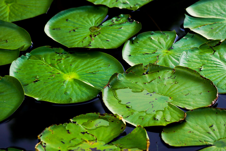
Because of the complications in assessing human disturbance in lakes using the invertebrate community, DEP developed methods involving the lake aquatic macrophyte community resulting in the Lake Vegetation Index (LVI), a multi-metric tool that assesses lake health based on the plant community structure. Four LVI metrics were chosen based on an HDG evaluation, and the LVI was subsequently calibrated via the BCG process. DEP currently uses the LVI as the primary method to assess biological health in Florida lakes. The LVI is sampled per DEP SOP LVI 1000 and calculated per DEP SOP LVI 2000. The LVI method involves dividing a lake into 12 units and identifying plants to the lowest possible taxonomic level in 4 of the 12 units. Plants are identified in each unit by a visual boat “drive by” and via a transect in each of the 4 units. A frotus is deployed a minimum of five times during the transect to assess the presence of submersed aquatic plants. All plants for a unit are recorded in a single column on the Lake Vegetation Index Field Sheet (FD 9000-27), and a dominant or co-dominant is assigned based on areal extent. Unknown plants are brought back for expert identification and verification. Florida is divided into two lake regions, north and south. For north Florida, the LVI sampling season is May through October, and the sampling season for south Florida is April through November. Data generated on the presence of species is used to calculate four biological metrics — each of which has been shown to respond to human disturbance. The metrics are:
Additional LVI Resources
The following documents provide additional resources on the development and use of the LVI.
Assessing the Biological Condition of Florida Lakes: Development of the Lake Vegetation Index – Fore, L. et al., 2007. Describes LVI index development and calculation.
Sampling and Use of the Lake Vegetation Index (LVI) for Assessing Lake Plant Communities in Florida: A Primer – DEP 2011. Provides information on sampling process and decision making involved with LVI.
Development of Aquatic Life Use Support Attainment Thresholds for Florida’s SCI and LVI – DEP 2011. Describes factors necessary to consider when developing a quantitative measure of biological health with focus on establishing the biological thresholds for the SCI and LVI.
Florida DEP has concluded the initial development of biological monitoring tools for wetland ecosystems. A research team led by Dr. Mark Brown of the University of Florida's Center for Wetlands investigated attributes from multiple biological assemblages in wetlands for use in the development of biocriteria for these systems. The wetland biological assessment tools consists of vegetation transects, 20 dipnet sweeps for macroinvertebrates and a qualitative periphyton sample collection. The University of Florida research team developed a classification scheme for Florida’s wetland types and completed a wetlands regionalization map.
The Wetland Condition Index has three components: a Wetland Vegetative Index, a Wetland Macroinvertebrate Index and a Wetland Diatom Index. All three indices are strongly correlated with the Landscape Development Intensity index (LDI). Wetland indices were developed for isolated herbaceous wetlands, isolated forested wetlands, and forested strands and floodplain wetlands (documents available on Report Search). These wetland tools have not yet been calibrated with the BCG or other approach and have not been incorporated in DEP rules.
In 2011 and 2012, DEP collected biological and water quality data from estuaries around the state to support the development of numeric nutrient criteria and to explore and refine biological assessment methods in estuarine environments for eventual statewide use. Sampling stations were in areas with minimal human impacts to establish baseline expectations. Site selection was based on a combination of aerial photographs, local knowledge, and a site reconnaissance. The biological communities targeted were epibenthic invertebrates and juvenile fish.
These groups were selected for study because in addition to providing important information on an estuary’s key ecological functioning, the effort level needed to sample and identify these organisms is practical from a human resource perspective. DEP used multiple gear types (fyke nets, beach seines and beam trawls) in each estuary to determine which gear, or combination of gears, would yield the best information for the level of sampling effort.
The information collected was included in a series of comprehensive technical support documents for each estuary and provided important baseline information and expectations for healthy epifaunal and juvenile fish communities for nearshore communities throughout Florida.
Interested in subscribing to DEP newsletters or receiving DEP updates through email?
Sign UpAbout DEP
The Florida Department of Environmental Protection is the state’s lead agency for environmental management and stewardship – protecting our air, water and land. The vision of the Florida Department of Environmental Protection is to create strong community partnerships, safeguard Florida’s natural resources and enhance its ecosystems.
Learn MoreContact
3900 Commonwealth Boulevard