Franklin County is known as the Forgotten Coast for its 53 miles of pristine mainland coast and many acres of parks. Barrier islands St. Vincent, Cape St. George, St. George, and Dog Island shelter the coast providing outdoor recreation activities for primitive campers and casual beachgoers alike.
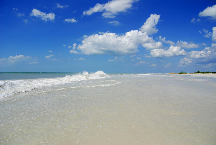
Across a 4-mile bridge is St. George Island, a 22-mile island complete with accommodations and a resort community. It is favored for its gulf waters and bay marshes, offering ample opportunity for swimming, paddling, and fishing. Visitors to the St. George Island State Park on the eastern side of the island enjoy canoeing, kayaking, hiking, and camping. Lucky visitors may spot a pod of bottlenose dolphins while enjoying a picnic along Gulf front beaches.
The three remaining barrier islands are accessible only by boat. The western most island of St. Vincent was established as a National Wildlife Refuge in 1968 and is popular for rugged hiking, fishing, and wildlife viewing. Additionally, the refuge hosts a red wolf recovery program to support the critically endangered mammal.
Conducting research and stewardship activities over 245,000 acres of Apalachicola River and Bay system is the Apalachicola National Estuarine Research Reserve, which is open to the public and offers a variety of environmental education events.
Within the Research Reserve is the Apalachicola Bay Aquatic Preserve. Its seagrass beds, mollusk reef, and salt marsh make it one of the most productive estuarine systems in the Northern Hemisphere. It is an important nursery for Gulf species like blue crabs, penaeid shrimp, sturgeon, speckled trout, and flounder.
Nestled between the Apalachicola River and the Ochlocknee River is Tate’s Hell State Forest, supporting wet prairie, wet flatwoods, strand swamp, bottomland forest, baygall and floodplain swamp communities. The forest is home to many rare species including the Florida black bear, bald eagle, and gopher tortoise. Trails in the forest allow for hiking, birding, and camping. Boat ramps, canoe launches, and docks are also available along the rivers and the coastline as part of the Florida Circumnavigational Saltwater Paddling Trail.
Two coastal towns, Carrabelle and Apalachicola, both feature a charming array of local shops, cafes, and art galleries. The region is famed for its seafood industry and oysters which have been sold locally since 1836, shaping culture, livelihoods, and conservation efforts.
| Franklin at a Glance |
|---|
| Coastal Cities | Apalachicola, Alligator Point, Carrabelle, Eastpoint |
| Popular Spot | St. George Island State Park |
| Sandy Beaches | 55 miles |
| Public Accesses | 69 |
| Great Florida Birding & Wildlife Trail | 11 sites |
| Federal Lands | Acres |
|---|
| Apalachicola National Estuarine Research Reserve | 246,766 |
Apalachicola National Forest (Leon, Liberty & Wakulla) | 567,742 |
| St. Vincent Island National Wildlife Refuge | 12,490 |
| Bays & Inlets |
|---|
| Alligator, Apalachicola, Big, Blounts, East & Little Ochlockonee bays, East & West bayous, Rattlesnake Cove, St. George & St. Vincent sounds |
| Rivers & Paddling Trails |
|---|
| Apalachicola, Little St. Marks, St. Marks, East, New, Crooked & Ochlocknee rivers, Florida Circumnavigational Saltwater Paddling Trail, Gulf Intracoastal Waterway |