
Download STATEMAP Products
Download over 20 years of STATEMAP research by clicking the open-file map series below or visit our interactive Story Map,
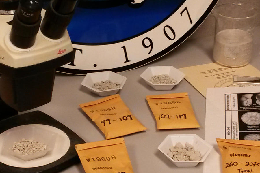
Geologic Mapping in Florida: The STATEMAP Program.

Click the thumbnail above to select and download STATEMAP products by area.
Surficial and Bedrock Geology of the Eastern Portion of the U.S.G.S. 1:100,000 Scale Homestead Quadrangle, by R. Green, K. Campbell, and T. Scott, 1995.
Surficial and Bedrock Geology of the Western Portion of the U.S.G.S. 1:100,000 Scale Homestead Quadrangle, by R. Green, K. Campbell, and T. Scott, 1996.
Surficial and Bedrock Geology of the Western Portion of the U.S.G.S. 1:100,000 Scale Sarasota Quadrangle, by R. Green, T. Scott, K. Campbell, J. Arthur, and G.H. Means, 1997.
Surficial and Bedrock Geology of the Eastern Portion of the U.S.G.S. 1:100,000 Scale Sarasota Quadrangle and the Western Portion of the U.S.G.S. 1:100,000 Scale Arcadia Quadrangle, South-Central Florida, by R. Green, T. Scott, K. Campbell, and G.H. Means, 1998.
Surficial and Bedrock Geology of the Eastern Portion of the U.S.G.S. 1:100,000 Scale Arcadia Quadrangle, South-Central Florida, by R. Green, G.H. Means, T. Scott, J. Arthur, and K. Campbell, 1999.
Surficial and Bedrock Geology of the Northern Portion of the U.S.G.S. 1:100,000 Scale Crestview Quadrangle, Northwestern Florida, by G.H. Means, R.C. Green, J.R. Bryan, T.M. Scott, K.M. Campbell, M.M. Gaboardi, and J.D. Robertson, 2000
Surficial and Bedrock Geology of the Southern Portion of the U.S.G.S. 1:100,000 Scale Crestview Quadrangle, Northwestern Florida, by R.C. Green, G.H. Means, T.M. Scott, M.M. Gaboardi, W.L. Evans, D.T. Paul, and K.M. Campbell, 2001
Surficial and Bedrock Geology of the Western Portion of the U.S.G.S. 1:100,000 Scale Marianna Quadrangle, Northwestern Florida, by R.C. Green, W.L. Evans, J.R. Bryan, D.T. Paul, and M.M. Gaboardi, 2002.
Surficial and Bedrock Geology of the Eastern Portion of the U.S.G.S. 1:100,000 Scale Marianna Quadrangle, Northwestern Florida, by R.C. Green, W.L. Evans, J.R. Bryan, and D.T. Paul, 2003.
Geologic Map of the Western Portion of the U.S.G.S. 1:100,000 Scale Gainesville Quadrangle, Northern Florida, by W.L. Evans, R.C. Green, J.R. Bryan, and D. T. Paul, 2004.
Geologic Map of the Eastern Portion of the U.S.G.S. 1:100,000 Scale Gainesville Quadrangle, Northern Florida, by R.C. Green, W.L. Evans III, D.T. Paul, and T.M. Scott, 2005.
Geologic Map of the Western Portion of the U.S.G.S. 1:100,000 Scale Lake City Quadrangle, Northern Florida, by R.C. Green, D.T. Paul, W.L. Evans III, T.M. Scott, and S.B. Petrushak, 2006.
Geologic map of the eastern portion of the U.S.G.S. Perry 30 x 60 minute quadrangle, northern Florida [3 plates], by R.C. Green, D.T. Paul, S.B. Petrushak, C. Kromhout, and T.M. Scott, 2007. Scale: 1:100,000. STATEMAP. Includes Open-File Report 91, Text to accompany geologic map of the eastern portion of the U.S.G.S. Perry 30 x 60 minute quadrangle, northern Florida, by R.C. Green, D.T. Paul, and T.M. Scott, 2007, 32 p.
Geologic map of the western portion of the U.S.G.S. Perry 30 x 60 minute quadrangle, northern Florida [3 plates], by R.C. Green, D.T. Paul, D.J. Wagner, C. Kromhout, and T. M. Scott, 2008. Scale: 1:100,000. STATEMAP. Includes Open-File Report 92, Text to accompany geologic map of the western portion of the U.S.G.S. Perry 30 x 60 minute quadrangle, northern Florida, by R.C. Green, D.T. Paul, and T.M. Scott, 2008, 35 p.
Geologic map of the eastern portion of the U.S.G.S. Ocala 30 x 60 minute quadrangle, north-central Florida [3 plates], by R.C. Green, C.P. Williams, D.T. Paul, C.Kromhout, and T.M. Scott, 2009. Scale: 1:100,000. STATEMAP. Includes Open-File Report 93, Text to accompany geologic map of the eastern portion of the U.S.G.S. Ocala 30 x 60 minute quadrangle, north-central Florida, by R.C. Green, C.P. Williams, D.T. Paul, C. Kromhout, and T.M. Scott, 2009, 28 p.
Geologic map of the western portion of the U.S.G.S. Ocala 30 X 60 minute quadrangle, north-central Florida [3 plates], by R.C. Green, C.P. Williams, A.D. Flor, D.T. Paul, C. Kromhout, and T.M. Scott, 2010. Scale: 1:100,000. STATEMAP. Includes Open-File Report 94, Text to accompany geologic map of the western portion of the U.S.G.S. Ocala 30 X 60 minute quadrangle, north-central Florida, by C.P. Williams, R.C. Green, A.D. Flor, D.T. Paul, T.M. Scott, and C. Kromhout, 2010, 29 p.
Geologic map of the eastern portion of the U.S.G.S. Inverness 30 x 60 minute quadrangle, central Florida [3 plates], by R.C. Green, C.P. Williams, K.E. Burdette, S.W. Bassett, A.D. Flor and D.T. Paul, 2011. Scale: 1:100,000. STATEMAP. Includes Open-File Report 96, Text to accompany geologic map of the eastern portion of the U.S.G.S. Inverness 30 X 60 minute quadrangle, central Florida, by C.P. Williams, K.E. Burdette, R.C. Green, S.W. Bassett, A.D. Flor, and D.T. Paul, 2011, 40 p.
Geologic map of the western portion of the U.S.G.S. Inverness 30 x 60 minute quadrangle, central Florida [3 plates], by C.P. Williams, R.C. Green, S.W. Bassett, L.M. Hannon and A.D. Flor, 2012. Scale 1:100,000. STATEMAP. Includes Open-File Report 97, Text to Accompany geologic map of the western portion of the U.S.G.S. Inverness 30 x 60 minute quadrangle, central Florida, by C.P. Williams and R.C. Green, 2012, 29 p.
Geologic map of the U.S.G.S. Tarpon Springs 30 x 60 minute quadrangle, central Florida [3 plates], by R.C. Green, W.L. Evans, C.P. Williams, C. Kromhout, S.W. Bassett, and L.M. Hannon, 2012. Scale: 1:100,000. STATEMAP. Includes Open-File Report 98, Text to accompany geologic map of the U.S.G.S. Tarpon Springs 30 x 60 minute quadrangle, central Florida, by R.C. Green, W.L. Evans III, C.P. Williams, C. Kromhout, and L.M. Hannon, 2012, 40 p.
Geologic map of the U.S.G.S. Daytona Beach 30 x 60 minute quadrangle, northeast Florida [3 plates], by R.C. Green, W.L. Evans III, S. W. Bassett, and L.M. Hannon, 2013. Scale: 1:100,000. STATEMAP. Includes Open-File Report 101, Text to accompany geologic map of the U.S.G.S. Daytona Beach 30 x 60 minute quadrangle, northeast Florida, by R.C. Green, W. L. Evans III, and S.W. Bassett, 2013, 37 p.
Geologic map of the U.S.G.S. Saint Augustine 30 x 60 minute quadrangle, northeast Florida [3 plates], by R.C. Green, C.P. Williams, K.M. Campbell, P.W. Bambach, L.M. Hannon, S.W. Bassett, W.L. Evans III, D.T. Paul, and B. Apolinar, 2014. Scale: 1:100,000. STATEMAP. Includes Open- File Report 102, Text to accompany geologic map of the U.S.G.S. Saint Augustine 30 x 60 minute quadrangle, northeast Florida, by R.C. Green, C.P. Williams, K.M. Campbell, P.W. Bambach, L.M. Hannon, S.W. Bassett, W.L. Evans III, D.T. Paul, and B. Apolinar, 2014, 34 p.
Geologic map of the U.S.G.S. Orlando 30 x 60 minute quadrangle, central Florida [3 plates], by R.C. Green, C.P. Williams, P.W. Bambach, L.M. Hannon, B. Apolinar, K.M. Campbell, and S.B. Dyer, 2015. Scale: 1:100,000. STATEMAP. Includes Open-File Report 104, Text to accompany geologic map of the U.S.G.S. Orlando 30 x 60 minute quadrangle, central Florida, by R.C. Green, C.P. Williams, P.W. Bambach, L.M. Hannon, B. Apolinar, K.M. Campbell, and S.B. Dyer, 2015, 37 p.
Geologic map of the U.S.G.S. Jacksonville 30 x 60 minute quadrangle, northeast Florida [3 plates], by R.C. Green, C.P. Williams, P.W. Bambach, B. Apolinar, L. M. Hannon, and K.M. White, 2016. Scale 1:100,000. STATEMAP. Includes Open-File Report 105, Text to accompany geologic map of the U.S.G.S. Jacksonville 30 x 60 minute quadrangle, northeast Florida, by R.C. Green, C.P. Williams, P.W. Bambach, B. Apolinar, L.M. Hannon, and K.M. White, 2016, 31 p.
Geologic map of the U.S.G.S. Saint Petersburg 30 x 60 minute quadrangle, west central Florida [3 plates], by R.C. Green, B. Apolinar, C.P. Williams, K.M. White, S.W. Bassett, and L.F. Nason, 2017. Scale 1:100,000. STATEMAP. Includes Open-File Report 106, Text to accompany geologic map of the U.S.G.S. Saint Petersburg 30 x 60 minute quadrangle, west central Florida, by R.C. Green, B. Apolinar, C.P. Williams, K.M. White, S.W. Bassett, and L.F. Nason, 2017, 45 p.
Geologic map of the U.S.G.S. Kissimmee 30 x 60 minute quadrangle, central Florida [3 plates], by R.C. Green, C.P. Williams, C.A. Albritton, K.M. White, A.G. Lamarche, S.W. Bassett, and L.F. Nason, 2018. Scale 1:100,000. STATEMAP. Includes Open-File Report 107, Text to accompany geologic map of the U.S.G.S. Kissimmee 30 x 60 minute quadrangle, central Florida, by R.C. Green, C.P. Williams, C.A. Albritton, K.M. White, A.G. Lamarche, and S.W. Bassett, 2018, 46 p.
Geologic map of the U.S.G.S. Bartow 30 x 60 minute quadrangle, central Florida [3 plates], by R.C. Green, C.P. Williams, A.G. Lamarche, C.L. Hebets, C.A. Albritton, and G.S. Evans, 2019. Scale 1:100,000. STATEMAP. Includes Open-File Report 108, Text to accompany geologic map of the U.S.G.S. Bartow 30 x 60 minute quadrangle, central Florida, by R.C. Green, C.P. Williams, A.G. Lamarche, C.L. Hebets, C.A. Albritton, and G.S. Evans, 2019, 41 p.
Geologic map of the U.S.G.S. Vero Beach 30 x 60 minute quadrangle, central Florida [3 plates], by R.C. Green, A.G. Lamarche, C.P. Williams, C.L. Hebets, G.S. Evans, and C.A. Albritton, 2021. Scale 1:100,000. STATEMAP. Includes Open-File Report 109, Text to accompany geologic map of the U.S.G.S. Vero Beach 30 x 60 minute quadrangle, central Florida, by R.C. Green, A.G. Lamarche, C.P. Williams, C.L. Hebets, G.S. Evans, and C.A. Albritton, 2021, 33 p.
Geologic map of the U.S.G.S. Fort Pierce 30 x 60 minute quadrangle, south Florida [3 plates], by R.C. Green, C.P. Williams, C.L. Hebets, J.W. Greene, N.P. Hall, G.S. Evans, and B.M. Duffey, 2022. Scale 1:100,000. STATEMAP. Includes Open-File Report 110, Text to accompany geologic map of the U.S.G.S. Fort Pierce 30 x 60 minute quadrangle, south Florida, by R.C. Green, C.P. Williams, C.L. Hebets, J.W. Greene, N.P. Hall, G.S. Evans, and B.M. Duffey, 2022, 33 p.
Geologic map of the U.S.G.S. West Palm Beach 30 x 60 minute quadrangle, south Florida [2 plates], by R.C. Green, J.W. Greene, N.P. Hall, C.L. Hebets, G.S. Evans, and C.P. Williams, 2023. Scale 1:100,000. STATEMAP. Includes Open-File Report 111, Text to accompany geologic map of the U.S.G.S. West Palm Beach 30 x 60 minute quadrangle, south Florida, by R.C. Green, J.W. Greene, N.P. Hall, C.L. Hebets, G.S. Evans, and C.P. Williams, 2023, 27 p.
Geologic map of the U.S.G.S. Cape Canaveral 30 x 60 minute quadrangle, central Florida [2 plates], by R.C. Green, C.P. Williams, J.W. Greene, C.L. Hebets, G.S. Evans, M.M. Ladle, N.P. Hall, and B.M. Duffey, 2023. Scale 1:100,000. STATEMAP. Includes Open-File Report 112, Text to accompany geologic map of the U.S.G.S. Cape Canaveral 30 x 60 minute quadrangle, central Florida, by J.W. Greene, C.P. Williams, R.C. Green, C.L. Hebets, G.S. Evans, M.M. Ladle, N.P. Hall, and B.M. Duffey, 2023, 28 p.
Geologic map of the U.S.G.S. Fort Myers 30 x 60 minute quadrangle, southwestern Florida, scale 1:100,000, [2 plates], by R.C., Green, Hall, N.P., Earley, P.A., Hebets, C.L., Jones, S.A., and Williams, C.P., 2024, scale 1:100,000. STATEMAP. Includes Open-File Report 113, Text to accompany geologic map of the U.S.G.S. Fort Myers 30 x 60 minute quadrangle, southwestern Florida, by Green, R.C., Hall, N.P., Earley, P.A., Hebets, C.L., Jones, S.A., and Williams, C.P, 39p.
Geologic map of the U.S.G.S. Naples 30 x 60 minute quadrangle, southwestern Florida, scale 1:100,000, [2 plates], by R.C., Green, Hall, N.P., Earley, P.A., Hebets, C.L., Jones, S.A., Williams, C.P., Davis. B.L., and McMahan, E.L., 2024, scale 1:100,000. STATEMAP. Includes Open-File Report 114, Text to accompany geologic map of the U.S.G.S. Naples 30 x 60 minute quadrangle, southwestern Florida, by R.C., Green, Hall, N.P., Earley, P.A., Hebets, C.L., Jones, S.A., Williams, C.P., Davis. B.L., and McMahan, E.L., 39p.