
Geologic Mapping
The Florida Geological Survey Mapping Initiative (FGSMI)
Contact: Clint Kromhout
The Florida Geological Survey Mapping Initiative (FGSMI) serves as the framework for accomplishing a long-term goal set by the Florida Geological Survey (FGS) to update the statewide surficial geologic map of Florida. The last published statewide surficial geologic map of Florida was published by Scott et al. (2001). Since then, the FGS has gathered additional geologic data and mapped about half of the state at higher resolution through the STATEMAP program. The FGSMI combines the research conducted by FLAGMAP, STATEMAP, and Earth MRI programs together to achieve the FGS’s long-term goal of updating the statewide surficial geologic map of Florida. The STATEMAP and Earth MRI programs are administered by the U. S. Geological Survey's (USGS) National Cooperative Geologic Mapping Program. STATEMAP projects are funded half by the USGS and matched by the State. Earth MRI projects are entirely funded by the USGS. FLAGMAP projects are funded solely by the FGS. The FGSMI is coordinated by the State Geologist (Guy H. Means) and Assistant State Geologist (Clint Kromhout).
FLAGMAP
Contact: Mary Beth Lupo
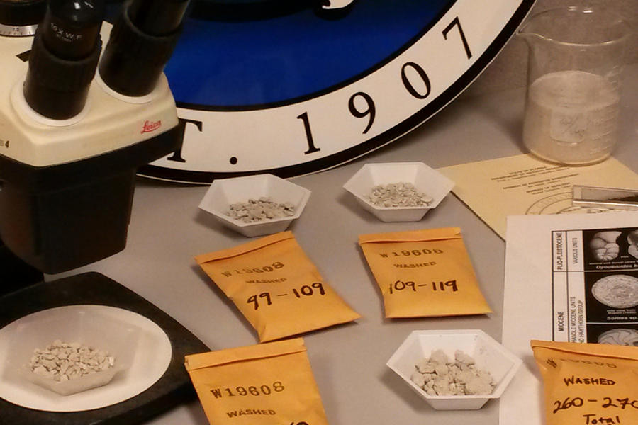
The Florida Geologic Mapping Program (FLAGMAP) works in parallel with STATEMAP and Earth MRI project areas to conduct new geologic mapping within non-STATEMAP and Earth MRI project areas. The density of data collected will vary based on local topography and stratigraphy. Data sources include strategically selected borehole samples from the FGS’s Geologic Sample Collections Facility, including newly drilled boreholes, to establish a network of wells serving as data control for surficial mapping and subsurface geologic modeling.
STATEMAP
Contact: Rick Green
The STATEMAP Program is a cooperative funding agreement between the U.S. Geological Survey (USGS) and State Geological Surveys through a competitive project proposal process. The Florida Geological Survey STATEMAP program was first established in 1994 with an award of just $30,000 from the USGS. Since then, it has become one of the premier STATEMAP programs in the U.S., with funding awards in the top five nationally for each of the last three years. Each year the STATEMAP team maps and reports on the geology of a different area of the state.
For more information about STATEMAP, visit our STATEMAP page or the interactive STATEMAP Story Map.

STATEMAP project geologists (Nick Hall and Preston Earley) examine an outcrop in a Naples canal.
Earth MRI
Contact: Mary Beth Lupo
The U.S. Geological Survey Earth Mineral Resources Initiative (MRI) Program provides funding for State Geological Surveys to collect geophysical, geochemical, geologic, and topographic data in areas of critical mineral potential across the Nation following Presidential Executive Order 13817 (2017) and Department of the Interior (Interior) Secretarial Order 3359. This initiative was established to evaluate critical mineral independence and security and assist in the collection of 2D and 3D-dimensional geospatial data to produce geologic maps per the National Geologic Mapping Act (Public Law 102-285) and the National Cooperative Geologic Mapping Program. The Florida Geological Survey first participated in the Earth MRI program in 2019. The Earth MRI team conducts surficial geologic mapping and geophysical and geochemical data interpretation with respect to the current project goals. Research includes:
- Geologic Mapping in the Trail Ridge Placers: Florida Focus Area (funded 2019) [Mary Beth Lupo]
- Geophysical Survey of the Alabama Piedmont and parts of the Alabama-Georgia-Florida East Gulf Coastal Plain (funded 2022; flown: TBD) [Mary Beth Lupo]
- Phosphate Waste Stream Geochemical Sampling (funded 2022) [Gary Fowler]
- Surficial Geologic Mapping in the Florida Panhandle and Statewide Mapping of Quartz Sand Resources (funded 2023) [Benjamin Davis]

Earth MRI project geologists (Mary Beth Lupo, Benjamin Davis, and Alan Baker) examine a quartz sand exposure along the St. Mary's River.