
Florida's Panhandle

Thirteen counties border what is known as the Forgotten Coast, with miles of undeveloped natural beaches, barrier islands, quiet fishing villages, quaint historic districts and popular beach-side cities and towns.
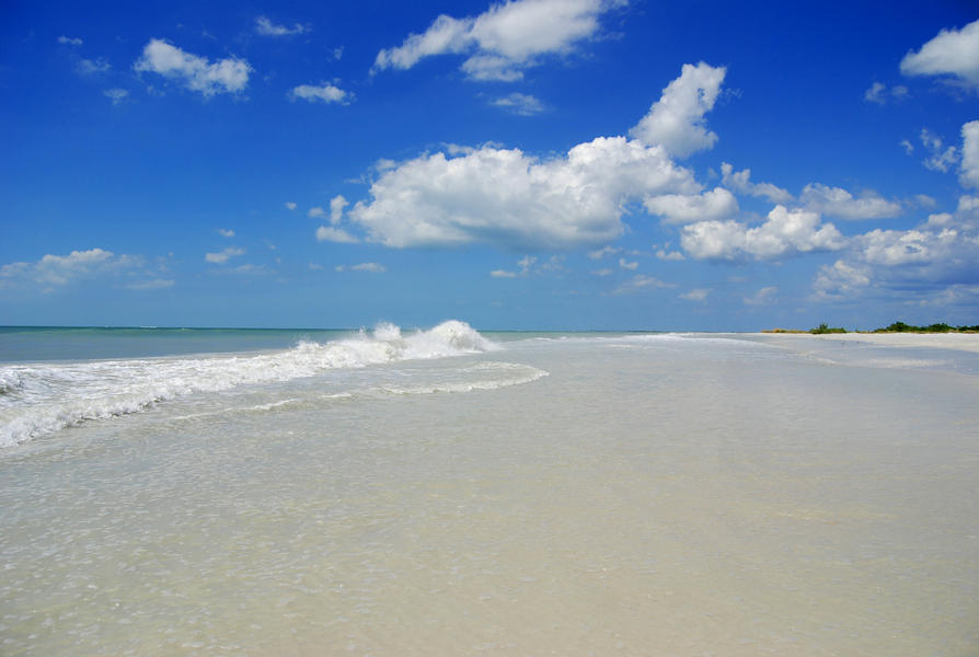
Renowned for sparkling white sands and emerald waters stretching from Pensacola southeast to Cedar Key along the Gulf of America, the Panhandle is one of Florida's best-kept secrets. Mostly rural, it boasts some of Florida's best beaches and a climate for year-round boating, biking, hiking, canoeing, scuba diving, snorkeling, kayaking, camping and fishing.
Panhandle sanctuaries include 10 aquatic preserves, 36 state parks, the Gulf Islands National Seashore and the 234,000-acre Apalachicola National Estuarine Research Reserve – one of the most important bird habitats in the United States' southeastern waters.
| Panhandle Counties (west to east) | Map |
|---|---|
| Escambia's sugar-white sand beaches of Pensacola Beach are its main attraction. It is on Santa Rosa Island, one of two barrier islands that shelter the mainland. (More) | Map |
| Santa Rosa's mainland is completely sheltered by Santa Rosa Island, home to Gulf Islands National Seashore, beautiful sand beaches and the city of Gulf Breeze. (More) | Map |
| Okaloosa beckons tourists to sugar-white sand beaches, resorts, sparkling green water, fishing and water activities. Its biggest city is Fort Walton followed by Destin. (More) | Map |
| Walton, one of the most biodiverse areas in the United States, attracts visitors to its beaches, dunes, rare coastal dune lakes and the 16 beach neighborhoods of South Walton. (More) | Map |
| Bay attracts hundreds of thousands of visitors to sandy white beaches and warm gulf waters that hide sunken shipwreck treasures. Panama City is a popular beach spot. (More) | Map |
| Gulf's miles of snow-white beaches, scalloping and sport fishing make it a popular area. The city of Port St. Joe looks across the bay at St. Joseph Peninsula State Park. (More) | Map |
| Franklin is reminiscent of the rural villages of the 1950s; much of the land is in conservation. St. George Island and the city of Apalachicola are main attractions. (More) | Map |
| Wakulla is home to Wakulla Springs and St. Marks National Wildlife Refuge, vast areas of wilderness, marsh and small secluded beaches. (More) | Map |
| Jefferson's coast is secluded wilderness and salt marsh for those with an explorer's spirit. (More) | Map |
| Taylor If you love fishing, the great outdoor wilderness and a slow pace, this is the place for you. (More) | Map |
| Dixie's wilderness and marsh on the Big Bend Seagrasses Aquatic Preserve offers fishing, boating and birding and one coastal city, Horseshoe Beach. (More) | Map |
| Levy is edged by wilderness, marsh, the Big Bend Seagrasses Aquatic Preserve, and the Suwannee and Withlacoochee Rivers. Cedar Key looks over this marshy coast. (More) | Map |
| Citrus, a prime fishing area, is the only place in the U.S. where people and manatees swim together, in Kings Bay near the city of Crystal River. (More) | Map |