
Terra Ceia Aquatic Preserve

The Terra Ceia Aquatic Preserve is located entirely within northwestern Manatee County. The preserve encompasses several inlets of southeastern Tampa Bay as well as much of the southeastern Tampa Bay shoreline.
Situated on either side of the Sunshine Skyway, the aquatic preserve is central to the Bradenton/St. Petersburg/Tampa area. The aquatic preserve's northern boundary begins just south of the mouth of Little Redfish Creek at Port Manatee. The southern boundary lies between the mouths of Terra Ceia Bay and the Manatee River at Emerson Point on Snead Island. The boundary extends northwesterly from these points out to the Manatee-Hillsborough county line and the Intracoastal Waterway, respectively, which then crosses and forms the outermost corner of the preserve.
With the exception of the city of Palmetto and the Palmetto Point subdivision, most of the adjacent uplands are within the Terra Ceia Florida Forever project. Bishop Harbor, Clambar Bay, Williams Bayou and the Terra Ceia River are bordered by state-owned uplands. Palmetto is the only incorporated city bordering the aquatic preserve.

The aquatic preserve is composed of state-owned submerged lands totaling 24,900 acres of predominately pristine submerged and wetland areas within Tampa Bay, Terra Ceia Bay, Miguel Bay, Joe Bay, Bishop Harbor and tidal waters of all tributaries including Frog Creek/Terra Ceia River and McMullen Creek.
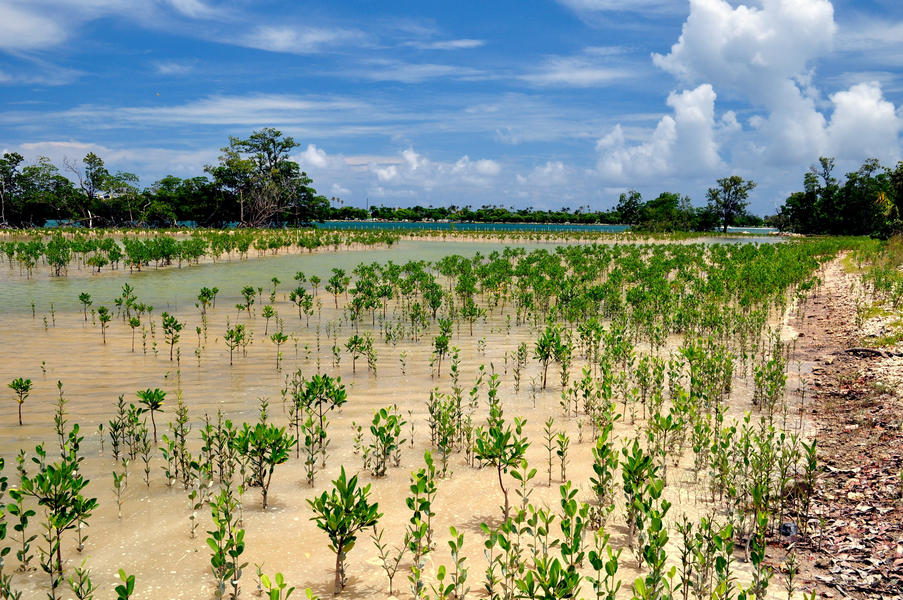
Terra Ceia Aquatic Preserve has open water, several inlet bays, and tidally influenced creeks and rivers and contains a diverse variety of natural communities, including seagrass, mangroves, salt marsh, tidal flats, hardbottom, oyster bars and clam beds.
By virtue of its location along southeast Tampa Bay, Terra Ceia represents much of the remaining undeveloped shoreline of one of Florida's most densely populated watersheds. With increasing urbanization, it is becoming more important that residents and visitors be able to drive a short distance down I-75 or I-275 and experience Tampa Bay in its natural state. For many, visiting the Terra Ceia area is like stepping back in time to experience the natural beauty that attracted early settlers to the Tampa Bay area. Such experiences create a public appreciation for the natural functions of ecosystems that do so much to provide clean water, clean air and abundant seafood for people.
The aquatic preserve contains a considerable amount of Tampa Bay's seagrass and much of the bay's hardbottom acreage. As a temperate/subtropical climatic transition zone, the area provides a natural workshop for the study of effects of climate change and urbanization that is yielding science-derived information of gulf-wide significance. This site provides a unique opportunity to study the effects of climate change regarding genetic adaptation, diversity, interaction, dominance shifts due to parasite/disease interaction, and changes in reproduction trends.
Terra Ceia Aquatic Preserve was designated as an Outstanding Florida Water on May 22, 1986.
- Terra Ceia Aquatic Preserve Management Plan was approved by the Acquisition and Restoration Council on June 11, 2009. The plan was approved by the Governor and Cabinet on Aug. 11, 2009.
United States
Public-use management focuses on providing public recreational opportunities that are compatible with resource management objectives. There is one boat ramp and two paddle-craft launches.
Approximately 90 prehistoric archaeological sites have been identified near Terra Ceia Aquatic Preserve.
Like most estuaries, Tampa Bay is a product of the fluctuations in sea level caused by glaciation. During times of lowered sea level, the river valley of Tampa Bay was cut into underlying limestone by its tributary rivers. As sea level rose during glacial retreat, the area was flooded and became Tampa Bay. The geomorphological landscape of Terra Ceia is a classic karst coastal terrain. Submerged lands and uplands are punctuated by sinkholes from past times when lower groundwater levels encouraged active karst processes.
As part of Tampa Bay, Terra Ceia Aquatic Preserve is characterized by the inlets and embayments of a drowned shoreline. The preserve has open water, several inlet bays, and tidally influenced creeks and rivers. Inlet bays include Bishop Harbor, Miguel Bay and Terra Ceia Bay. Adjacent to Bishop Harbor, two additional inlets can be found: Williams Bayou and Clambar Bay. Miguel Bay is formed from the mainland and Rattlesnake Key. The largest inlet, Terra Ceia Bay, is bisected by the U.S. 19 bridge.
The open water of the aquatic preserve is bisected by the Sunshine Skyway and its southern causeway approach. Terra Ceia River/Frog Creek and McMullen Creek provide freshwater to the system. The tidally influenced portions of these water bodies are part of the aquatic preserve.
Interested in subscribing to DEP newsletters or receiving DEP updates through email?
Sign UpThe Florida Department of Environmental Protection is the state’s lead agency for environmental management and stewardship – protecting our air, water and land. The vision of the Florida Department of Environmental Protection is to create strong community partnerships, safeguard Florida’s natural resources and enhance its ecosystems.
Learn MoreTallahassee, Florida 32399-3000 Public.Services@FloridaDEP.gov 850-245-2118
